
Map the Castle Rock Block by Source
A block lookup works when each source is assigned a narrow question. The county parcel map locates the land, the Assessor supplies account and ownership fields, the Town layer supplies neighborhood geography, election records show only permitted voter fields, and USPS confirms the postal line. The resulting table is a coverage map, not a list of everyone nearby.
| Source | What It Shows About a Block | Access |
|---|---|---|
| Douglas Real Property Viewer and GIS | Parcel polygons, touching lots, account links, subdivision context, tax layers, and boundary geography. | Public map hub and parcel browsing. |
| Douglas County Assessor parcel card | Account, state parcel, situs, owner display, legal description, value, tax authority, and sales links for a selected parcel. | Basic or advanced public search. |
| Town Neighborhoods ArcGIS and MapServer | Neighborhood boundary, subdivision, HOA, master-neighborhood, public URL, and contact fields. | Interactive map, query, or export; no member roster. |
| Douglas County and Colorado voter data | Registration, residence, mailing, precinct, district, and election-administration fields for eligible, non-confidential records. | Self lookup or official list request under election rules. |
| USPS ZIP4 and county Addressing | Deliverable street line, unit, ZIP or ZIP+4, and proposed, released, or recorded address context. | USPS form and county application; not a person search. |
| Library directories and newspapers | Dated household, phone, public-role, business, obituary, or address clues for earlier periods. | Digital guide, microfilm, reading room, or archivist request. |
Owners and occupants are not interchangeable. A parcel record can identify a displayed owner or entity. A mailing address can be a tax-contact line. A voter field can identify an eligible registration at a dated address. A neighborhood boundary can show that a parcel falls within a mapped area. None of those facts alone proves that every person in the household is present now.
For a block question, preserve the source date and the exact claim. A careful answer might say “these parcels touch the anchor parcel,” “this account displays an owner,” or “this voter record contains a residence field.” It should not turn several narrow records into a universal list of Castle Rock neighbors.
The Douglas County voter-list fields and access rules are shown in this Castle Rock neighbors image. The source is useful for understanding the record shape, while confidential and excluded fields remain outside the public result.
A map-based block search should use the voter layer as a restricted confirmation route, never as a shortcut around the county's request and confidentiality rules.
Turn One Castle Rock Address into Adjacent Parcels
Begin with one confirmed street line and retain its original spelling. Search the Assessor, record the account and state parcel, then use the county map to walk from the anchor polygon to the parcels that touch it. A useful process keeps the geography and person fields separate:
- Normalize the house number, directional, street type, unit, postal city, state, and ZIP, but save the submitted wording beside the normalized line.
- Search the Douglas County Assessor and record the situs, account, state parcel number, legal description, subdivision, lot, block, and search date.
- Open the Real Property Viewer, click the anchor parcel, and identify touching polygons and their account or situs links.
- Check the Town neighborhood layer and the municipal boundary. A road, drainage tract, alley, common area, or county line can make visual closeness different from legal adjacency.
- Open each selected parcel's public Assessor record and state whether the displayed name is an owner or entity, not a confirmed occupant.
- For a whole named street, move to the Castle Rock street directory workflow rather than calling a block browse a full street search.
The inspected public layers do not expose a dedicated radius or buffer control. Describe map browse, parcel clicks, and a documented feature query instead of promising an automatic circle around an address. An adjacent parcel can be separated by a road, alley, drainage strip, common area, or a different jurisdiction. State which relationship the map actually shows.
Note: Keep a parcel ID and a map date with each neighbor result because boundary layers, ownership displays, and source links can change.
Castle Rock Parcel Cards Hold Narrow Fields
The indexed Douglas County parcel card for account R0057306 shows why a neighbor result needs a field inventory. It lists account R0057306, state parcel number 235115004041, owner fields for Scott W. Forsyth and an additional owner entry, mailing and situs address 5243 Mesa Drive, Castle Rock, ZIP 80108, legal description Lot 150 Happy Canyon 5, 2.323 acres, assessed and actual value lines, taxing authority and mill data, sales-history links, and a parcel-detail route.
Those fields are valuable for locating the parcel beside an anchor address and for checking the legal description. They are not proof that the named owner lives at the situs, that the additional owner is a household member, or that the account describes every person using the property. The tax-account route also warns that the Assessor is the more current parcel source, so quote the source and date rather than presenting the sample as a timeless fact.
- Account and parcel
- R0057306 and state parcel 235115004041 identify the county record crosswalk.
- Owner fields
- The card displays Scott W. Forsyth and an additional owner field as account data.
- Situs and mailing
- 5243 Mesa Drive, Castle Rock, 80108 appears in the indexed sample; the two address roles must still be kept distinct.
- Legal description
- Lot 150 Happy Canyon 5 and 2.323 acres supply a parcel identity that can be compared with a map.
- Administrative values
- Assessment, actual value, taxing authority, mill data, and sales links describe the account rather than a household.
The official R0057306 parcel card is the most concrete way to see how a Castle Rock block can be researched without claiming more than the public fields support.
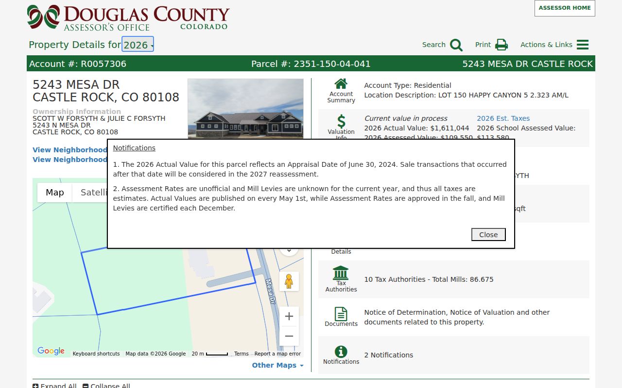
Use the card to anchor the parcel, then return to the map for the touching lots. Do not publish extra mailing or contact fields when a parcel relationship is enough to answer the question.
Town Neighborhood Layers Around Castle Rock
The Town's Neighborhoods page and ArcGIS experience add community geography to parcel research. The Town layer maps more than 150 neighborhoods and offers address or name search, boundary browsing, and links to association or property-management information. The public Neighborhood MapServer supports feature queries and export. Its fields include HOA, subdivision, master-neighborhood, public URL, and contact information.
These fields tell where an address falls and which public association link belongs with the polygon. They do not reveal member names, dues, household contacts, or a universal association roster. The layer can also be current while a parcel card or directory is dated differently, so retain the layer date and the URL returned for the polygon.
| Neighborhood layer route | Public access or contact | Use and limit |
|---|---|---|
| Town Neighborhoods page | Castle Rock neighborhood links | Start an address or name browse; association links are geographic leads, not membership evidence. |
| ArcGIS experience | Interactive map | Inspect boundaries and linked community context; keep the map date and selected polygon. |
| Neighborhood MapServer | Public REST query and export | Query HOA, subdivision, master-neighborhood, URL, and contact fields; no radius tool or member list. |
The Town neighborhood map is the community-geography layer shown in this Castle Rock neighbors image. Its value is the boundary and public association context, not a claim about who belongs to a household.
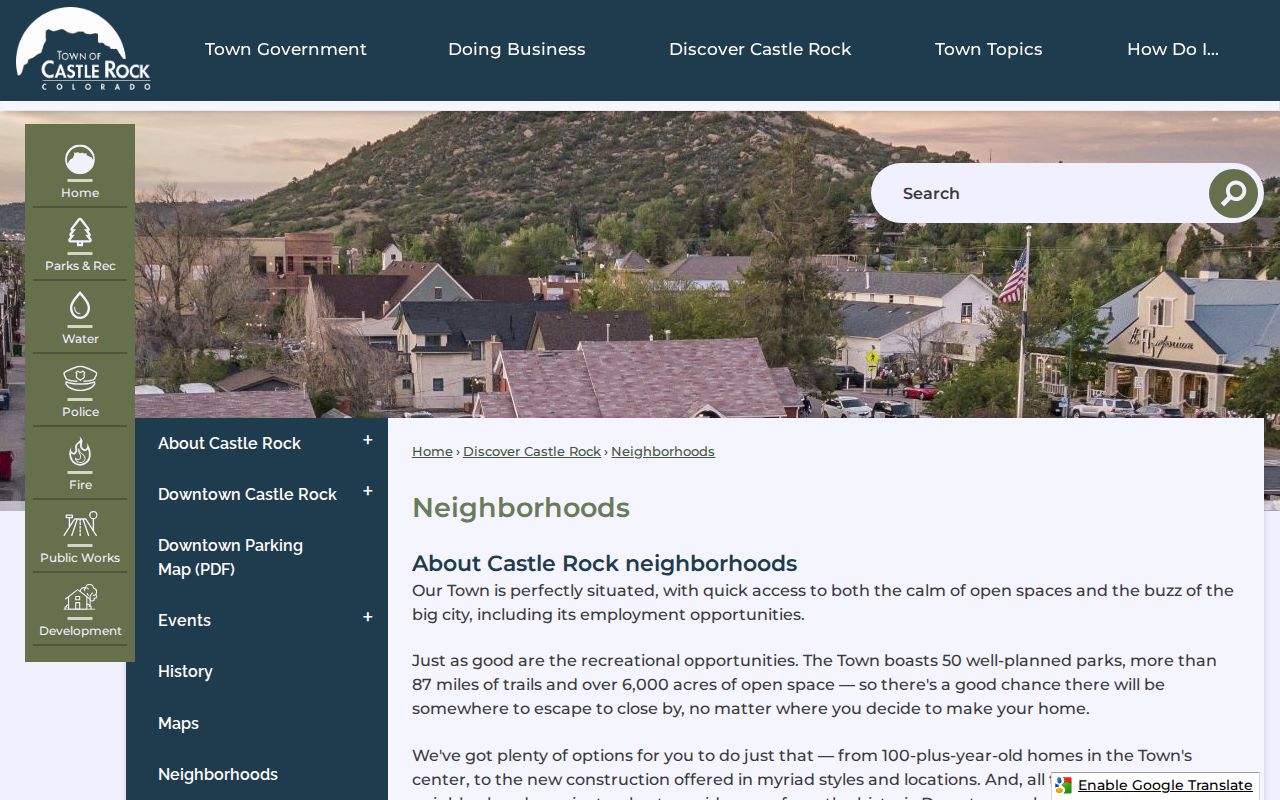
After the image, the correct next step is to query the selected polygon or follow its official public URL, then return to the parcel record for the address-specific fact.
Castle Rock ZIP, Town, and County Boundaries
Castle Rock's postal city includes ZIP codes 80104, 80108, and 80109. The USPS ZIP4 lookup is the source for an individual deliverable line, unit, ZIP, and ZIP+4. A general ZIP map cannot decide whether an address is inside Town limits, in unincorporated Douglas County, or in a neighborhood polygon that crosses another local layer.
Use the Town annexation page with the county map before assigning a custodian. A Castle Rock mailing label can sit outside the Town, while a Town parcel can have county assessor, recorder, election, and special-district records. Postal city, municipal boundary, parcel authority, neighborhood, ZIP, and election district should be retained as separate fields.
When a new, split, renumbered, or missing address causes a mismatch, the Douglas County Addressing application asks for requester name, phone, email, state parcel number, county account, project type, description, and proposed, released, or recorded address information. County Addressing lists 303-660-7411. The application resolves situs identity and emergency-address context; it is not a public list of Castle Rock neighbors.
Castle Rock Voter Fields Need a Date
Douglas County Elections publishes a standard voter list updated every business day and a master voter-history list after each election. The field guides distinguish voter ID, name, registration status and dates, residence and mailing address, phone when supplied, precinct and district assignments, and election-administration fields. They exclude confidential voters, preregistered people under 18, Social Security numbers, driver-license or state-ID numbers, electronic voter signatures, email addresses, and how a person voted.
The Colorado Secretary of State self lookup asks for first name, last name, ZIP Code, and birthday in MM/DD/YYYY format. It is designed for a person to check registration and election information, not for an unrestricted block roster. A protected record, old ZIP, spelling difference, or no-match result can prevent a result. For a public file, use the Douglas County voter-list request route or the state data-request form, and preserve the effective date.
Voter data can help confirm that a particular public field is tied to a residence address and district. It cannot show every Castle Rock neighbor, every household member, or the selections made on a ballot. ACP and other protected records must remain out of an address-based inference.
Note: A voter address is a dated election record, so do not merge it with a current parcel or neighborhood result without naming both dates.
Castle Rock Neighborhood Names Need Care
The Town layer contains useful association and master-neighborhood examples, but a mapped name is not a claim of membership. These examples can help identify the public link attached to an address:
- Crystal Valley Ranch master neighborhoods include Hillside, The Grove, and Rhyolite Ranch.
- Founders Village appears with the Founders Village Master Association.
- Timber Canyon is mapped within Metzler Ranch.
- Escavera Master Owners Association and Castle Villas Condominium Association appear as distinct mapped areas.
- Montaine includes Regency at Montaine and Vista at Montaine master neighborhoods.
- Plum Creek groups include The Knolls, Ryder Cup, Sawgrass Community Association, Players Crossing, Players Club Villas, Estates Above Plum Creek, The Pines, and Champions Court.
- The Meadows and Azure Villas at the Meadows are also identified in the neighborhood layer.
The Town does not publish one complete civic-association or member directory in the inspected sources. Follow the current public URL or phone field attached to the selected polygon. The Town neighborhood page is the safest starting point for a current community link, while the MapServer supplies the underlying geography and field labels.
Do not infer that a person owns, joins, or lives in an association because a parcel lies inside its mapped boundary. A neighborhood polygon describes place. A parcel card, permit, voter field, or dated directory supplies a separate record that must stand on its own.
Official Castle Rock Records Versus Commercial Profiles
Commercial neighbor profiles are a category, not an authoritative local layer. They may combine parcel, address, phone, voter, and historical directory fragments into a generated result, but the date, source, and join logic may be unclear. Official Castle Rock sources are slower and more limited, yet their custodian and field meaning can be checked:
| Source type | Best evidence | Built-in limit |
|---|---|---|
| County parcel map and Assessor | Adjacent land, account, situs, legal description, and displayed owner or entity. | Not a complete occupancy or household record. |
| County voter data | Dated registration, address, precinct, district, and election-administration fields where public. | Protected voters and excluded fields are omitted; not every person is registered. |
| Town neighborhood layer | Mapped boundary, association or management link, HOA, subdivision, and master-neighborhood fields. | No member names, universal roster, or automatic radius result. |
| Commercial neighbor profile | A compiled lead that may point back to public records. | May be stale, misjoined, paywalled, or difficult to audit. |
For a lawful block question, start with the official parcel and map, then add only the record type that answers the next narrow question. A public source can be incomplete while still being more defensible than a profile whose inputs cannot be traced.
Privacy for Castle Rock Neighbors
Public parcel geography does not open private household details. Utility customers, delivery records, motor-vehicle address data, unlisted contacts, and many court or vital-record details are controlled by separate rules. Colorado's Address Confidentiality Program provides qualifying survivors of domestic violence, sexual offenses, and stalking with a substitute legal address and confidential mail forwarding. The certification lasts four years with re-enrollment, and state and local agencies accept the substitute address as the legal address of record.
A normal parcel, ZIP, voter, or neighborhood search must not be used to work around that protection. If a map shows an adjacent polygon but no public owner field, report the geography only. If a public field is protected or redacted, do not reconstruct it from another source. If the source sweep does not locate a complete block roster, say so rather than filling the gap with a guess.
Lawful personal use. Castle Rock neighbors research can support civic curiosity, local history, personal reconnection, and safety awareness. Do not use an address result to stalk, harass, intimidate, or harm anyone, and respect a custodian's access limits and protected-address rules.