
Walk a Castle Rock Street by Address
A useful address search begins with a normalized line, not a guess about a person. Douglas County treats the Assessor parcel as the bridge between a street line and a legal description. The voter lookup can confirm a registration for an eligible, non-confidential voter, while a deed proves a recorded transfer and a historical directory supplies only a dated lead. Keep the source date beside every result. For a current address question, search in this order:
- Run the house number and street name through the Douglas County Assessor Property Search. Capture the account, state parcel number, situs line, mailing line, subdivision, and legal description.
- Open the county Real Property Viewer and GIS map hub. Check the parcel shape, municipal boundary, tax context, ZIP layer, and nearby lots.
- Use the Colorado voter lookup only for its stated self-confirmation route. A no-match or protected result does not establish that no one lives at the address.
- Take the legal description or a confirmed party name to Douglas County LandmarkWeb. Search the recorder by party, legal description, reception number, book and page, or date.
- For an earlier household, ask the Miller Library Archives and Local History collection about dated phone books, newspapers, and reverse directories. Match the old street wording to a period map before joining it to a modern parcel.
The result should say what the evidence supports: an owner shown on an account, a parcel touching the street, an instrument recorded by the Clerk and Recorder, a permit applicant, or a dated directory entry. Calling all of those people current residents would flatten distinct records into a claim none of them makes.
Douglas Assessor Fields for Castle Rock Streets
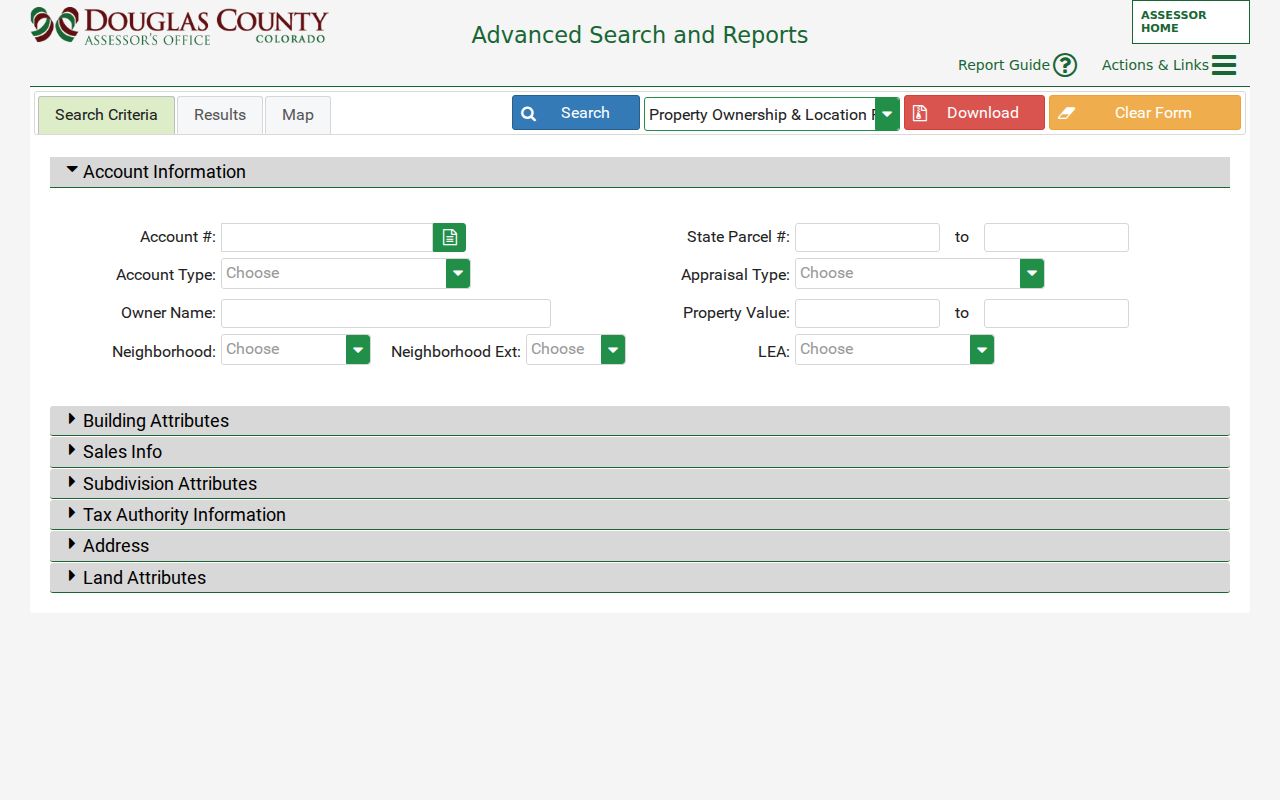
The Douglas County Assessor basic search offers “All/Search All Fields,” “Address, City, and Zip Code,” “Owner Name,” “Account Number,” and “State Parcel Number.” A result can be sorted by Best Match, Account, Owner, or Address. The advanced search adds street ranges, subdivision, lot, block, tract, sale information, grantor, grantee, and building details. These are the fields that make Castle Rock address research reproducible:
| Assessor field | Type | Required? | Options and notes |
|---|---|---|---|
| Address, City, Zip Code | Text fields | No | Combine for a narrow result; sort by Best Match, Account, Owner, or Address. |
| Owner Name | Text | No | People, trusts, and companies can appear as displayed in the account. |
| Account Number | Text | No | Best when the tax account is already known. |
| State Parcel Number | Text or range | No | Use for the parcel crosswalk; the advanced form supports from and to values. |
| Street number and name | Range and text | No | Search a segment of one street without treating the street as a resident list. |
| Sales and deed fields | Date, text, select, range | No | Recording number, deed type, grantor, grantee, sale price, date, and qualified or multi-parcel status. |
| Subdivision and land | Text, select, range | No | Subdivision, filing description, block, lot, tract, township, section, range, acres, and land use. |
Use one or two fields first. A broad query can return several accounts for a common number, a condominium, a split parcel, or a street that crosses a boundary. The parcel card can show owner, mailing address, situs address, legal description, values, tax authorities, sales history, and links into recorded documents. It does not prove that the displayed owner sleeps at the situs, and a mailing address may point elsewhere.
The Assessor search screen is the starting point shown in this Castle Rock address-search image. The portal's disclaimer is part of the evidence, so retain the account and search date when citing a result.
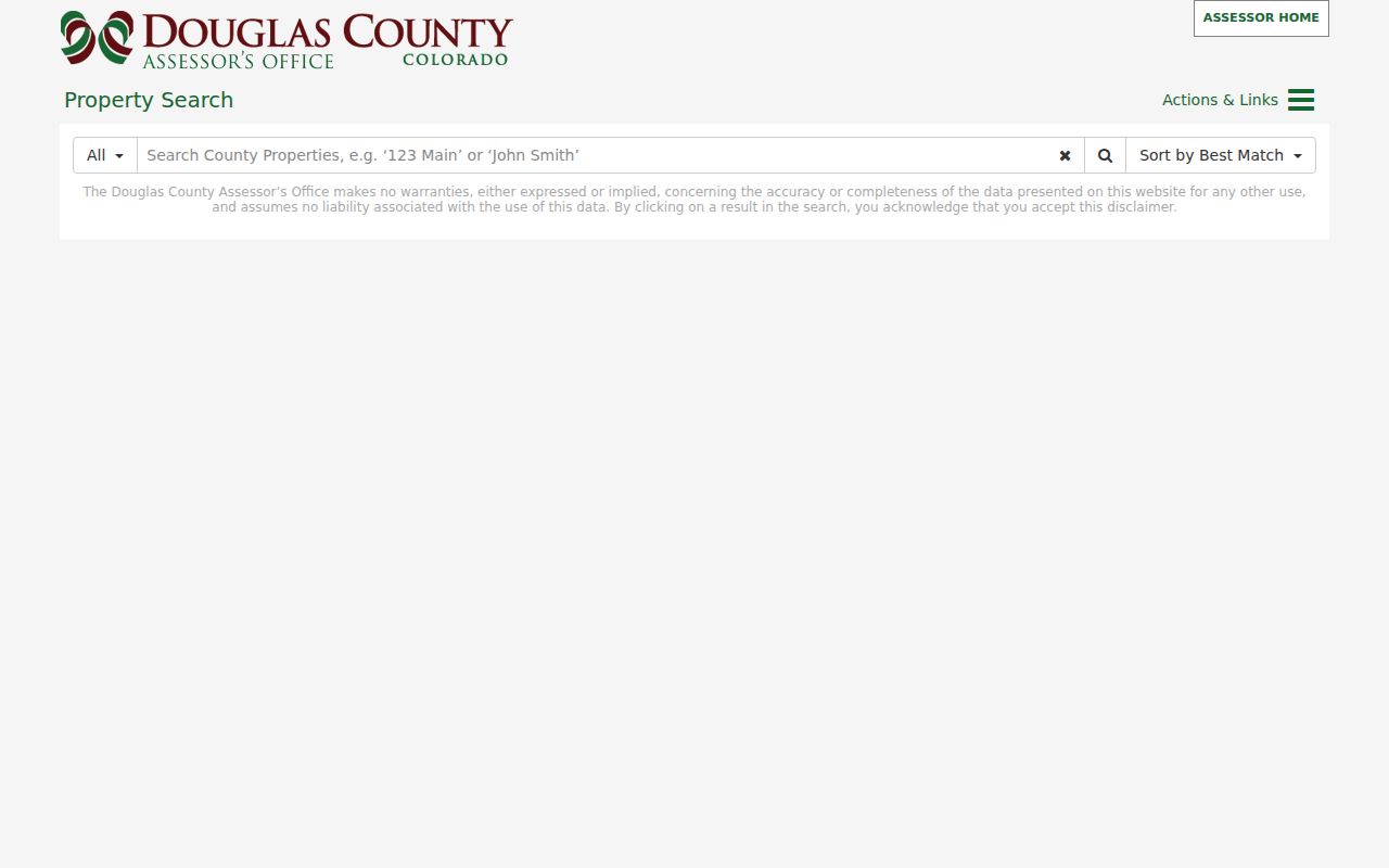
The basic form is convenient for a first pass, while the advanced form is better when a name collision or multiple parcels makes a street search too broad.
Real Property Viewer Maps Castle Rock Streets
Douglas County's Real Property Viewer and assessor map page add geography to the account search. Parcel polygons, subdivision and lot context, tax districts, ZIP layers, zoning, sections, and municipal boundaries help explain why two records with a similar street line may belong to different custodians. Click the anchor parcel, inspect the legal description, then pan across touching polygons. A map can show that parcels are adjacent; it cannot turn visual proximity into a household roster.
The indexed parcel detail for Douglas account R0406253 is a useful field example from the public system. Its sales history shows reception numbers, dates, deed types, parties, book, and page. The sample is outside Castle Rock, so it is not evidence about a Castle Rock owner. It demonstrates how a parcel card can lead to the deed index and how a directory entry should label the geography instead of silently localizing an outside record.
The map also helps resolve units, common street numbers, and parcels that sit just beyond a Town line. Keep the assessor's situs wording, the state parcel number, and the map date. If the question shifts from a whole street to one individual, a Castle Rock resident lookup needs the same source-date discipline but a different verification path.
The R0406253 parcel-detail capture displays the kind of sales and legal fields that connect an address to recorded instruments. The location and account must still be checked before the sample is used in a local search.
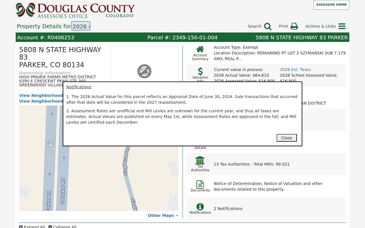
That distinction keeps an address directory accurate when a county portal contains examples from the wider county rather than only the Town.
Castle Rock Records Searchable by Street
Each address-keyed record set has a narrow job. The table below keeps an address directory from overstating what a source can show. Use the account and parcel to join county systems, then preserve the name, date, and role exactly as the source displays them.
| Record keyed to an address | Custodian | What it can show | Access |
|---|---|---|---|
| Assessor parcel and tax card | Douglas County Assessor and Treasurer | Account, state parcel, situs, owner display, mailing address where shown, legal description, value, tax authority, and sales links. | Public web search; cite account and date. |
| GIS parcel and boundary map | Douglas County and Town GIS | Parcel shape, adjacent polygons, subdivision and lot context, ZIP, district, and Town or county boundary layers. | Public map viewers and map-service queries. |
| Recorded instruments | Douglas County Clerk and Recorder | Grantor, grantee, reception or instrument number, record date, document type, book, page, legal description, and image. | LandmarkWeb, research station, or request. |
| Voter residential address | Douglas County Elections and Colorado SOS | Registration and district fields for eligible, non-confidential records. | Self lookup or public-file request under election rules. |
| Permits and inspections | Castle Rock eTRAKiT or Douglas County Building | Permit number, site address, applicant or owner labels, dates, work type, contractor, and inspection results when exposed. | Public report, portal search, or records request. |
| Address assignment | Douglas County Addressing and Town GIS | State parcel, account, proposed, released, or recorded address information and numbering context. | Application and office route; not a person index. |
| Historical directory or newspaper | Miller Library, archives, and regional collections | Dated occupant, business, phone, public-role, obituary, or address clue. | Digital guide, microfilm, database, or archivist request. |
- Parcel
- A county-assigned piece of land identified by an account, state parcel number, legal description, and map shape.
- Situs address
- The physical location assigned to the parcel. It can differ from the owner's mailing address.
- Plat
- A recorded map that lays out lots, blocks, streets, easements, or subdivision lines used to read an address.
- Criss-cross directory
- A reverse directory arranged by address or telephone number, usually a dated lead to a name rather than a current resident record.
The chain is strongest when one fact is not asked to do another source's work. A permit applicant is not automatically an occupant. A voter record omits people who are not registered and people protected by confidentiality rules. A directory listing belongs to its publication date. A deed party has a recorded interest or conveyance, not a guaranteed residence.
Note: Keep the original address, parcel number, source URL, and date checked together when a street result may be revisited.
Castle Rock Deeds Start With Legal Description
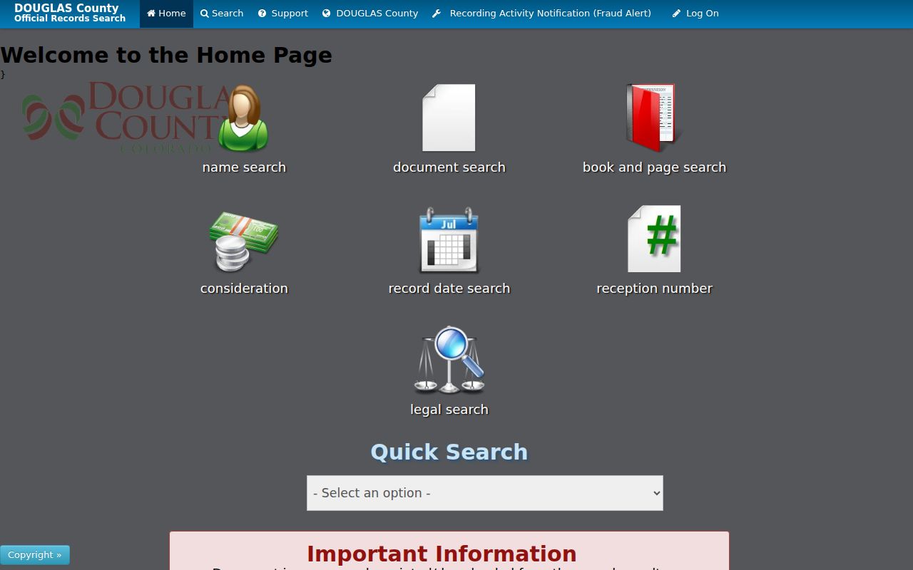
The Douglas County Recording Division says a street address is not the recorder's indexing key. Start with the Assessor's subdivision, lot, block, tract, legal description, account, or state parcel number, then search the LandmarkWeb recorder portal. Name searches use the indexed “Last Name, First Name” form, while company names should be entered as shown on the document. The visible search families include name, document type, book and page, consideration, record date, reception or instrument, legal search, quick search, and marriage search.
Older material needs care. Chronological recorded images reach into the 1800s, but Douglas County does not state one clean online-index cutoff and says some historic images remain at office research stations. For pre-2002 reception numbers, the county instructs researchers to use Contains. Historic metadata may not show the correct book, page, or reception information, so an empty online result is a prompt to try the legal description, a party name, a date range, or the county's index books.
The Recording Division instructions also explain the practical access route. The office is at 301 Wilcox Street in Castle Rock, is open Monday through Friday from 8 a.m. to 5 p.m., and lists 303-660-7446 for recording questions. The office's research stations provide older index books and image access, and a reservation is recommended. Certified copies come from the Recording Office, not from an assessor screen.
The advanced Assessor search view shows how an address search can narrow a parcel by subdivision, sales, deed, and land fields before the legal-description-first recorder step. It keeps a common name or street segment from becoming an unmarked list.
A second LandmarkWeb recorder view shows why party, document, book, page, date, and legal filters should be recorded separately. The same name can occur in more than one county instrument.
Search the latest transfer, read the grantor and grantee, then move backward one instrument at a time. A quitclaim, public trustee deed, estate, trust, or company transfer should be described as that instrument, not recast as a household change.
Castle Rock Permits Mark Address Events
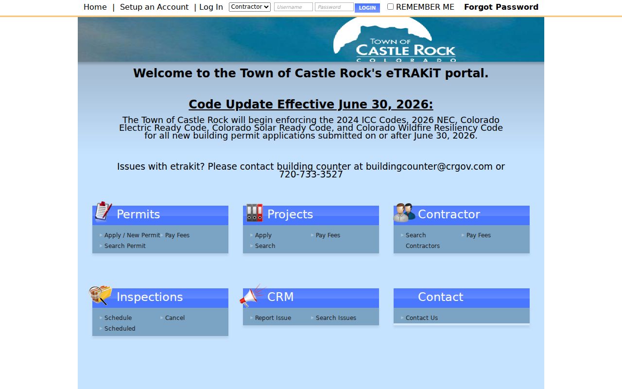
The Town's eTRAKiT portal supplies another address trail through permits, inspections, projects, complaints, contractors, and CRM issues. The CRM route exposes search selectors and fields for last name, phone, email, and issue number, with Info, History, Subject, and Complainant tabs after a result is opened. Contractor searches expose license, insurance, contact, fee, and chronology tabs. Some direct permit paths require login, so a public report or a Town records request is safer than promising that every permit is searchable online.
Public sample permit 24-3264 describes a pergola at 5598 Missoula Trail, Castle Rock, Colorado 80108. It lists an application date of August 15, 2024, approval on January 13, 2025, issuance on January 14, 2025, applicant Albert Manjarrez, owner Calla Christine and Albert Manjarrez, and inspection entries with dates, type, inspector, result, and notes. Those labels prove a dated permit transaction. They do not prove present occupancy.
A Douglas County simple building permit search accepts permit number, street number, and street name. Its advanced route adds dates, subdivision, state parcel number, building or unit, business name, contractor company, certificate dates, and other project fields. Narrow the date, street, or parcel before relying on a large result set.
The eTRAKiT portal is the address-event layer shown in this street page image. The public report makes the sample's date and role fields visible without changing what the record can prove.
When a project is missing from the public menu, retain the address and permit number and ask the Town custodian for the permitted record instead of filling the gap with an inference.
Castle Rock's Six Original Streets
Street history changes the way an old address should be read. Castle Rock became the Douglas County seat in 1874 after a 120-acre donation by Jeremiah Gould, and the early central grid used the names Jerry, Elbert, Wilcox, Perry, Castle, and Front. The Town says the community was founded in 1874, the Denver and Rio Grande depot arrived in 1875, and Castle Rock incorporated in 1881. A newspaper notice that says only “Front Street” or “near the depot” may be searchable even when a modern house number is absent.
- 1874: Preserve the period street name and compare it with the Town's history and walking-tour material.
- 1875: Use the depot-era map and newspaper context to place a business, home, or public role.
- 1881: Check whether the record concerns the incorporated Town, the larger county, or a nearby settlement.
The Town history pages are context sources, not a searchable resident roll. Keep the historic wording, name the map or newspaper used for a crosswalk, and mark a modern parcel as a reasoned translation. Do not silently attach a current ZIP or owner to an 1880s line.
Note: A dated map can resolve a street clue, but it cannot by itself establish that a named person lived at the later parcel.
Castle Rock ZIP, Town, and County Boundaries
USPS and municipal geography answer different questions. Castle Rock postal-city addresses use 80104, 80108, and 80109, while nearby postal labels include Franktown, Kiowa, Larkspur, and Sedalia. The individual USPS ZIP4 lookup is the source for a deliverable street line, unit, ZIP, and ZIP+4. The county map page links USPS ZIP4 beside its ZIP and boundary layers because a ZIP polygon or centroid is not a definitive answer for one address.
The Town annexation material is just as important. A Castle Rock mailing address can sit outside Town limits, and a recognizable Castle Rock location can be governed by Douglas County rather than Town offices. Use the county Assessor, Recorder, Addressing, Sheriff, and court when the parcel is outside Town; add Town permits, municipal records, or municipal court only when the boundary supports it.
For an address that is new, split, renumbered, or absent, use the Douglas County address-request application. It asks for the requester, state parcel number, county account, project type, description, and proposed, released, or recorded address details. County Addressing lists 303-660-7411. This is an official address-assignment route for county systems and emergency response, not a person index.
Note: Preserve the postal city, ZIP, Town or county status, and assessor situs as separate fields when the same street crosses a jurisdiction line.
Castle Rock Reverse Directories Need Dates
Historical reverse directories can be valuable for a past household, but Castle Rock's coverage is not a continuous public roster. The Miller Library guide confirms local phone books from 1966 through 1973. A regional Colorado directories index describes broader city, telephone, and criss-cross material, including a mostly Denver and metro series from 1924 through 2018 and a digitized 1924 through 1937 segment. A standalone, continuously indexed Castle Rock Polk run was not located.
Search a dated reverse section by the exact address, record the household spelling and publication year, then compare the street or block with a period newspaper, map, deed, or parcel. Castle Rock's six original streets make an old “Front” or “Wilcox” reference useful, but the town grid, annexations, and address changes can break a direct text match. A directory entry is a lead to verify, not proof of an uninterrupted residence.
The DCL local-history guide is the right request route when a reverse volume is not digitized. Ask whether an uncataloged or reading-room phone book exists and request the issue or page. The Castle Rock city directory collection notes describe the older shelf, newspaper windows, and archive fallback without turning a regional volume into a complete local list.
Note: If the library cannot confirm a Castle Rock volume, state the gap and cite the dated source that was actually checked.
Where the Castle Rock Street Directory Stops
An address source can connect a place to an official record, but it cannot reveal every person associated with a household. The Assessor shows an owner or administrative mailing line. A deed shows a recorded instrument. A permit shows an applicant or owner label tied to a project. The voter file excludes confidential records and people who are not registered. Historical directories show a dated publication snapshot. None of these is a complete list of occupants, visitors, or household members.
Do not try to fill the gap with utility, delivery, motor-vehicle, or other restricted data. Colorado's address confidentiality program provides qualifying survivors with a substitute legal address and confidential mail forwarding. A normal address search must not be used to work around that protection. When the source does not support a person-to-address claim, write “no official public directory for every address on this street was located” and keep the research path visible.
Lawful personal use. Castle Rock address records can support genealogy, property history, civic research, and personal reconnection. Do not use an address directory to stalk, harass, intimidate, or harm anyone, and stop when a custodian or protected-record rule limits access.